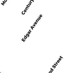
6 EDGAR TERR
Owner Information
LEON LUIS A
6 EDGAR TERR
SOMERVILLE, MA 02143


Property Details
6 EDGAR TERR is classified as a Three-Family Residential (3-decker).
The primary structure on this property was built in 1910. There are 5,068ft2 of built area within this property. There is 3,295ft2 of residential/living space within this property. This property is listed as having 15 rooms.
6 EDGAR TERR is valued at $938,900. The land is valued at $249,700 and the structures are valued at $689,200.
This property is in Zone NR. Confirm with local Zoning Board authorities to ensure there are no overlays or other easements on this property.
The most recent deed for 6 EDGAR TERR is recorded at the local registrar in Book 53472, Page 28. 6 EDGAR TERR was last sold on Monday, August 31, 2009 for $435,000.
Assessment data from fiscal year 2021.
Flood Data
According to the FEMA National Flood Hazard Layer, this property does not appear to be in a flood zone. It may also be in an area not yet reviewed. Nonetheless, confirm this information prior to taking any action.
To view the flood hazards around this property, create a FEMA "Firmette" Map of the area around 6 EDGAR TERR.
Broadband Internet Providers
| Provider | Type | Bandwidth (mbps) | |
|---|---|---|---|
| GCI Communication Corp. | Satellite | 0 | 0 |
| Viasat Inc | Satellite | 100 | 3 |
| Verizon New England Inc. | DSL | 15 | 1 |
| netBlazr Inc | Fixed Wireless | 50 | 50 |
| VSAT Systems, LLC. | Satellite | 2 | 1 |
| HughesNet | Satellite | 25 | 3 |
| Comcast | Cable | 1000 | 35 |
| RCN | Cable | 500 | 20 |
| RCN | Cable | 1000 | 20 |
| Starry, Inc. | Fixed Wireless | 200 | 200 |
Broadband service provider data from December 2020.
Adjacent Properties
- 10 EDGAR TERR
Three-Family Residential owned by CICONE GIOVANNA FOR LIFE - 34 EDGAR AVE #34
Residential Condominium owned by HARRIS ADAM & CIBRA VINCENZO - 2 EDGAR TERR
Three-Family Residential owned by NASSON PAUL ARTHUR FOR LIFE - 111 HEATH ST #1
Residential Condominium owned by ANDROSENKA ALENA P - 111 HEATH ST #2
Residential Condominium owned by LEE STEVEN J - 113 HEATH ST #1
Residential Condominium owned by SPAHIU ISAK & KONOMI FLORA - 113 HEATH ST #2
Residential Condominium owned by THAKKER MILAN - 117 HEATH ST #1
Residential Condominium owned by LEBLANC ALLIE & DUFFY MARK - 117 HEATH ST #2
Residential Condominium owned by ERRANTE JOSEPH & DEBORAH TRUSTEES - 119 HEATH ST #2
Residential Condominium owned by HOEFER ASHLEY - 121 HEATH ST #1
Residential Condominium owned by KO ALEXI TAYLOR - 121 HEATH ST #2
Residential Condominium owned by OWENS ERIC ANDREW & DIONNE - 123 HEATH ST
Residential Condominium owned by MAHARJAN HARI & NEERA MAHARJAN - 36 EDGAR AVE #1
Residential Condominium owned by LIU JUNQUING - 36 EDGAR AVE #2
Residential Condominium owned by HODKINSON SARAH TRUSTEE - 38 EDGAR AVE #1
Residential Condominium owned by CHEN WILLIAM - 38 EDGAR AVE #2
Residential Condominium owned by VARLEY ANDREW & MARION LATENDRESSE - 36-38 EDGAR AVE
Other, Open Space owned by None - 119 HEATH ST #1
Residential Condominium owned by BRODERICK NATHANIEL O